“Geography is just physics slowed down, with a couple of trees stuck in it.” -Terry Pratchett (Terrence David John ‘Terry’ Pratchett (1948 - 2015)): “The Last Continent” (1998)
Charles: What part of London is in France?
Pierre: The letter ‘n.’
If the world is getting smaller, how come they keep raising the postal rates?
Son: Dad, where are the Himalayas?
Father: Go ask your mother - she puts everything away.
Law of Location: No matter where you go, there you are!
Buster: What was the tallest mountain in the world before Mount Everest was discovered?
Lester: Mount Everest.
Knock, knock.
Who’s there?
Ida.
Ida, who?
Ida hoes potatoes!
Geography Facts
- Map-making is older than writing.
- People who make maps are called cartographers.
- A body of water is a lake, river, ocean, or other water mass usually on or below a planet’s surface.
- The Global Positioning System (GPS) is a method of allowing people to find precise coordinates, or locations, using satellite telemetry (measurements from a distance).
- Terrain features are features on the surface of a planet or object, such as mountains, hills, valleys, bodies of water, volcanoes, plains, shorelines, glaciers, bays, and so forth.
- The most commonly used map is the road map; however, there are many other types of maps, including terrain maps, mineral location maps, undersea maps, and aerial navigation maps . . . and, as some joker just said, don’t forget treasure maps.
Ricky: How can you name the capital of every U.S. state in two seconds?
Mickey: Washington, D.C.
Timbuktu
A thing that I’ve wanted to do
Is to go to that place, Timbuktu.
It’s perfectly clear
It’s a long way from here.
But no one knows just where - do you?
by Author Unknown
Brenda: Where is Timbuktu?
Herbie: Between Timbukone and Timbukthree.
“I heard him speak disrespectfully of the equator.” -Sydney Smith (1771 - 1845)
Equator: An imaginary lion running around the Earth through Africa.
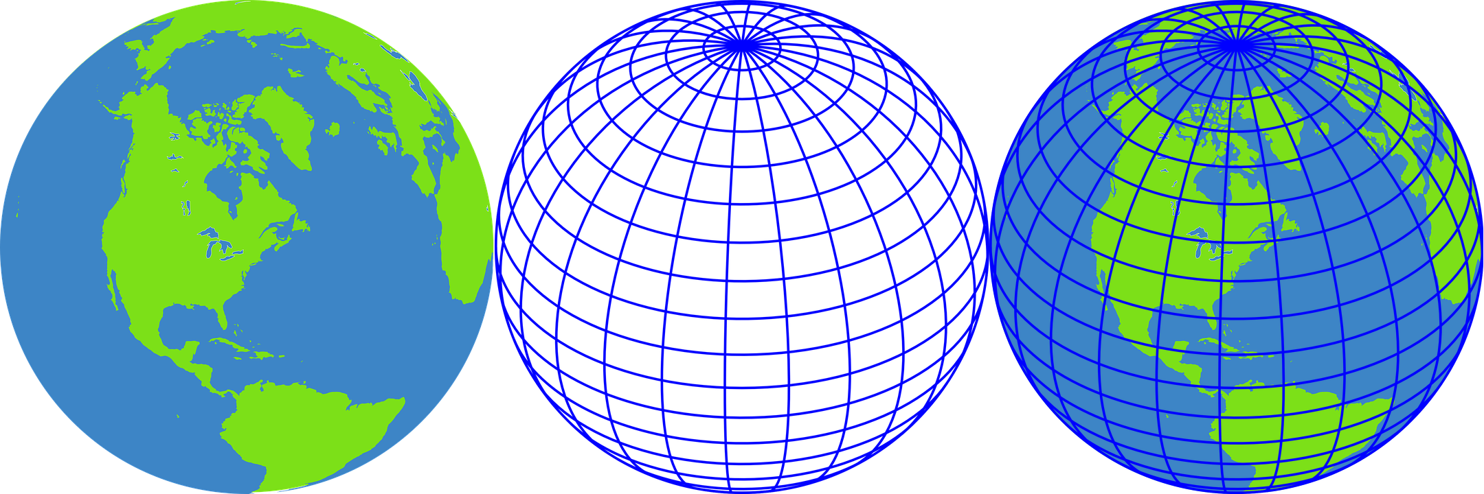
Lines of latitude, including the famous Equator, are parallel horizontal lines, and lines of longitude are lines drawn from the North Pole to the South Pole, or if you prefer, lines drawn around the Earth that go through the poles. The imaginary lines are placed on maps of the face, or surface, of the Earth, and are the means by which ships and people can find their locations and navigate, or travel, to their destinations. Latitude was devised by measuring the height of the Sun in the sky, and longitude was calculated by comparing the time shown on two clocks, with one adjusted to show local time and the other remaining unaltered.
Homer: Why is longitude like a clothes line?
Elmer: Because it stretches from pole to pole.
Greenwich Observatory in Greenwich, England, was established by King Charles II in 1675 to study means of fixing longitude, and became the acknowledged center of world authorities on the subject. Telescopes and other instruments at Greenwich Observatory were used to determine the exact position of the meridian. In 1884, an international conference in Washington, District of Columbia, United States of America, agreed Greenwich should be the site of zero longitude, both on the Earth and on maps of the Earth.
“If you don’t know where you are, a map won’t help.” -Watts S. Humphrey
The concept of dividing the globe into longitudinal strips, or bands, to establish time zones, was first proposed by Sweden’s Alex Andersrag. He has long since been forgotten, except in a few obscure history books, so few people today refer to these zone dividers as ‘Alex Andersrag Time Bands.’ Someone has just said that this may be at least partly fictitious . . .
All time zones across the world are expressed as being plus or minus a certain number of hours of ‘Greenwich Mean Time.’ The ‘prime meridian’ is set at zero degrees longitude, where it passes through Greenwich. In the courtyard of the observatory, brass strips have been set in the ground and walls marking the exact location. In this location, a person can stand over the line of brass strips, with one foot in each hemisphere.
There was an Old Man on the Border,
Who lived in the utmost disorder;
He danced with the Cat,
And made Tea in his Hat,
Which vexed all the folks on the Border.
-Edward Lear (1812 - 1888): “More Nonsense, Pictures, Rhymes, Botany, etc.” (1872)
“You can’t get there from here if you don’t know where here and there are.” -Thom Hogan
Chance: What did Delaware?
Hope: Her New Jersey.
You Are Entering Littleville
Altitude 1,580
Population 3,775
Founded 1837
Total 7,192
Jay: What is the difference between here and there?
Kay: The letter ‘t.’
According to some people, the area called Iceland is so cold that most of its citizens have to live somewhere else.
Vera: Why is honey so hard to find in Boston?
Sarah: Because there is only one ‘B’ in Boston.
A good sense of humor is helpful for those who live in the following places:
- Beebeetown, Iowa
- Cheesequake, New Jersey
- Chocolate Bayou, Texas
- Hot Coffee, Mississippi
- Hygiene, Colorado
- Monkey’s Eyebrow, Arizona
- Pumpkin Center, Missouri
- Santa Claus, Indiana
- Shoulderblade, Kentucky
- Smileyberg, Kansas
- Truth Or Consequences, New Mexico
- Yeehaw Junction, Florida
Marcella: What has four i’s but cannot see?
Marcus: Mississippi.
The Russian Federation and the United States of America are only 2 miles away from each other by kayak, in the far north, just in case you are bored and want something to do. Be sure to take along some granola and seal blubber.
Gulf: A dent in a continent.
If the Roman Empire does not exist any longer, why is there is a city named Rome on every continent?
Why is north at the top of maps? The ancient Greeks and ancient Romans put the east at the top of their maps because that is the direction from which the Sun rose. The early Christian nations did so too, because it was believed that the Garden of Eden had been located in the east. North gradually moved to the top of the map near the beginning of the 14th century, as armies, emissaries, and traders increasingly traveled north towards Europe, where a larger human population could be found.
Geography Teacher: Who knows where the Great Plains are?
Student: At the big airports?
On a map, the ‘You Are Here,’ sometimes with an arrow pointing to your location, is called an ‘ideo locator.’ Yay, we're here! We've finally arrived!
“Where is here?” -Northrop Frye
More than seventy-five percent of all the countries in the world are located north of the Equator.
Dustin: What is the difference between the North Pole and the South Pole?
Geography Teacher: All the difference in the world!
The names of the continents all end with the same letter with which they start.
Marcus: Where is Moscow?
Mark: In the barn with Pa’s cow.
Thirteen recognized countries in the world have capital cities with spellings that begin and end with the same letter, in the English language versions of the names. They are: Abuja (Nigeria), Accra (Ghana), Addis Ababa (Ethiopia), Andorra la Vella (Andorra), Ankara (Turkey), Apia (Samoa), Asmara (Eritrea), Astana (Kazakhstan), Oslo (Norway), Saint George’s (Grenada), Saint John’s (Antigua and Barbuda), Tashkent (Uzbekistan), and Warsaw (Poland).
Geography Quiz
- What countries border the country you live in?
- Why are some countries divided into areas called states or provinces?
- What is the capital city of your country?
- What is a body of water?
- Are there places in the world that are not claimed as a part of any country?
- What country is the ‘most fun country’ for its citizens?
“We’re not lost. We’re locationally challenged.” -John M. Ford
Spencer: South Africa is the only country with three official capitals - what are they?
Percy: South Africa’s three official capitals are Pretoria, Cape Town, and Bloemfontein.
Melanesia
Each fall in far-off Melanesia
The weather’s not likely to please ya;
Hurricanes come and go,
Giant tides ebb and flow,
And octopi tease ya and squeeze ya.
by Author Unknown
Amanda: What was the smallest continent in the world before Australia was discovered?
Angela: Australia.
Road Map: A guide to etiquette showing motorists which fork to use.
This is MFOL! . . . visit as often as your imagination needs encouraging . . .
